Mt. Kushigatayama Hiking Guide | From the Ike-no-Chaya Forest Road to old-growth forest and the Ayamedaira iris fields · Course times
Difficulty & route
Intermediate
Mt. Kushigatayama (2,052 m), one of the 200 Famous Mountains, rises on the Koma Mountains of the Southern Alps front range. Its highlights are the mossy old-growth forest, the giant larch trees, and the flower meadows of Ayamedaira. It can be walked as an easy loop from the Ike-no-Chaya Forest Road.
Kushigatayama2,052m
Elevation
2,052m
Course time
A loop from the Ike-no-Chaya Forest Road trailhead — about 4 hours 24 minutes (editor's measured time, incl. breaks)
Best season
May to July (fresh greenery and irises). The moss and giant trees of the old-growth forest are worth seeing all year round.
Distance
10.8km
Total ascent
742m
Parking
Parking at the Ike-no-Chaya Forest Road trailhead. The forest road may be closed in winter.
0:00Elapsed0.0km1,848m
Elevation profileEditor's measured GPX · surface distance10.9kmRoute overviewEditor's measured GPS route on the GSI base map ·10.9km
LocationMinami-Alps City and Fujikawa Town, Minamikoma District, Yamanashi (front range of the Southern Alps / Koma Mountains)
TrailheadIke-no-Chaya Forest Road trailhead/Minami-Alps City, Yamanashi35.5849, 138.3625Open in Google Maps →
AccessBy car: from Minami-Alps IC or Masuho IC on the Chubu-Odan Expressway, take the Maruyama Forest Road and Ike-no-Chaya Forest Road to the trailhead. The forest roads are narrow and may be closed in winter.
Coordinates are the trailhead and summit points from the editor's own GPS track.
Watch
Watch this hike on video
Editor's note
Editor's note
編集長
Climbed on:2026-07-02
Mt. Kushigatayama is a 2,052 m peak on the Koma Mountains of the Southern Alps front range, one of the 200 Famous Mountains. Seen from the side it has the gentle profile of a Japanese comb laid face down, and it is known for its mossy old-growth forest, its giant larch trees, and the early-summer flower meadows of Ayamedaira. The Hokuto editor walked this peak — which also serves as a viewing platform for the Southern Alps — and sets it out here from first-hand experience.
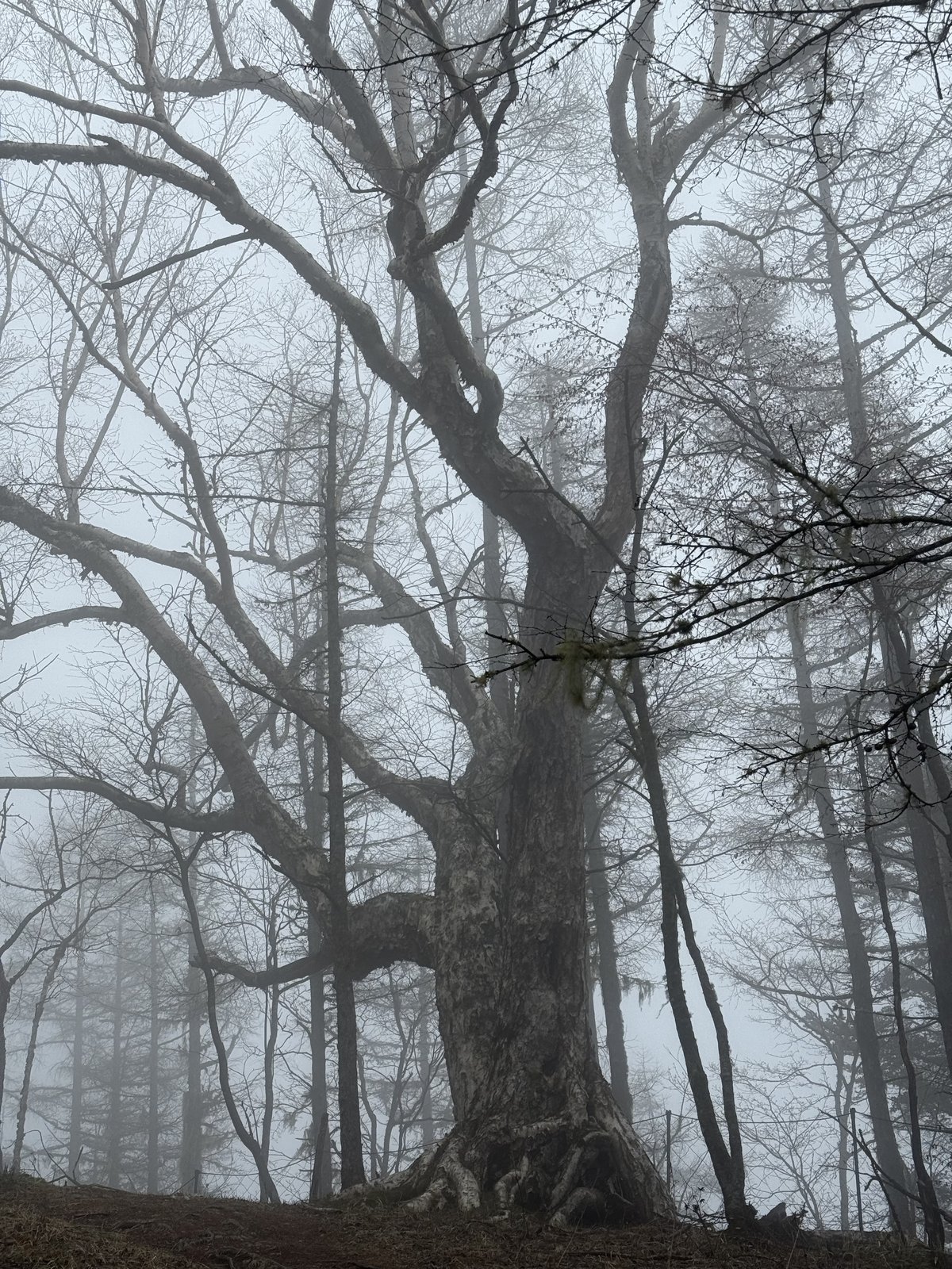
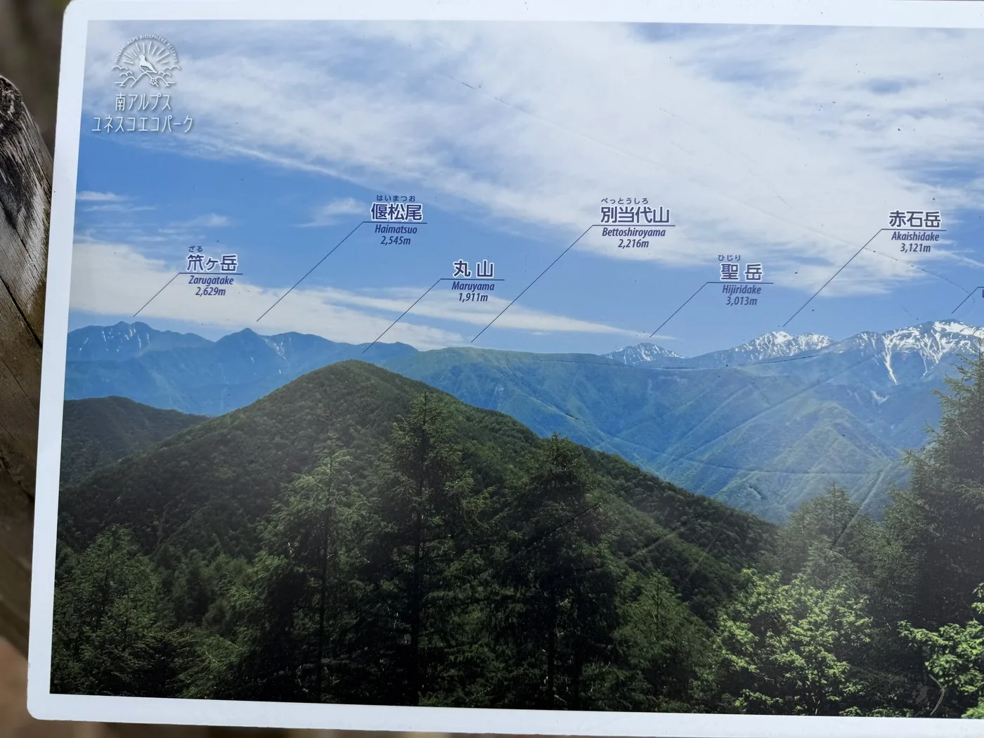
I walked it in the fresh greenery of May. From the Ike-no-Chaya Forest Road trailhead it is a loop taking in the highest point of Okusenju and the triangulation point of Kushigatayama, then going around Hadakayama and Ayamedaira. Unfortunately it was misty, but the Veitch fir and larch old-growth forest sunk in mist, and the mossy giant trees, felt all the more otherworldly for it. The view of the Southern Alps from the Kitadake deck could only be imagined from the information board, but that too becomes a pleasure to save for next time.
The editor's measured time was about 4 hours 24 minutes including breaks (departing 06:27, summiting 7:11, descending 10:52), over a distance of about 10.8 km. With a small elevation change and few dangerous spots, it is a relaxed peak to walk. It was a forest that makes you want to visit again in the early summer when the irises bloom, or on a fine day when the air is clear.
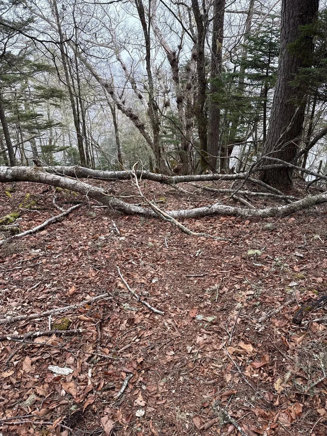
The trails cross one another in the old-growth forest and it is easy to get lost when mist rolls in, so check your map and GPS. If you are after the views, head to the Kitadake viewing deck on a fine day. To protect the vegetation, do not stray from the trail for the flowers and moss of Ayamedaira. The Ike-no-Chaya Forest Road is narrow and can be closed in winter, so check road conditions in advance.
Routes
Choose your route
The Ike-no-Chaya Forest Road route (loop via Okusenju and Ayamedaira)
Loop
Difficulty
Intermediate
Approx. time
About 4h24m (editor's measured time) / standard about 5h
Day trip
Day trip · Beginner to Intermediate
A loop from the Ike-no-Chaya Forest Road trailhead that takes in the highest point of Okusenju (2,053 m) and the triangulation point of Kushigatayama, then goes around Hadakayama, Ayamedaira and Mt. Karamatsu. The elevation change is small, and it is a relaxed peak where you can enjoy the mossy old-growth forest, the giant larch trees and the early-summer iris colonies. In fine weather the Kitadake viewing deck opens up a grand panorama of the Southern Alps.
The Maruyama Forest Road / Nao-One route (from the foot)
Out & back
Difficulty
Intermediate
Approx. time
Climbing from the foot involves a large elevation change
Day trip
For strong walkers
There is also a classic route with a large elevation change, climbing the Nao-One trail and others from the foot. Compared with driving up to the Ike-no-Chaya Forest Road, it is more demanding to climb, and lets you savour the deep old-growth forest at length.
Editor's record
Editor's measured times
The editor's actual timings on this hike (from the video record). Use them as a guide to course times.
06:27Depart the Ike-no-Chaya Forest Road trailhead
07:11Reach the summit of Kushigatayama (2,052 m; the highest point is Okusenju, 2,053 m)
07:51Hadakayama (an iris habitat)
08:39Toward Mt. Karamatsu and the Kitadake viewing deck
10:52Descend to the trailhead (loop, about 4h24m)
History & culture
History & culture
Mt. Kushigatayama is a 2,052 m peak rising on the Koma Mountains of the Southern Alps front range, and one of the 200 Famous Mountains of Japan. It sits on the boundary between Minami-Alps City and Fujikawa Town in Yamanashi, and as its name suggests, seen from the side it has the gentle profile of a Japanese comb (kushi) laid face down.
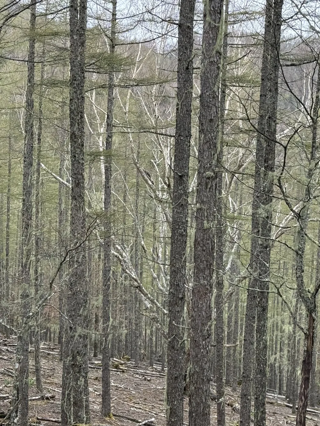
Its highest point is Okusenju (2,053 m), just north of the triangulation point (2,052 m), and the area is cloaked in deep old-growth forest of Veitch fir and larch. The mossy forest and the groves of large-girthed giant larch trees are highlights unique to Kushigatayama.
The area around 'Ayamedaira' and 'Hadakayama' on the ridge was once known as one of Japan's foremost habitats for irises, and dainty flowers bloom there in early summer. From the Kitadake viewing deck set on the summit area, in fine weather you can look out at close range on Kitadake and the other high peaks of the Southern Alps.
Photos
Photos from the trail
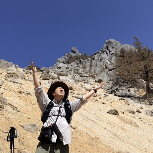
All photos were taken by the editor on the actual hike. Tap to enlarge.
If you drive up to the Ike-no-Chaya Forest Road trailhead the elevation change is small, and even the loop is easy to walk at about 4 to 5 hours. There are almost no dangerous rocky sections, so it suits beginners to intermediate hikers. That said, the trails cross one another in the old-growth forest and it is easy to get lost when mist rolls in, so don't forget to check your map and GPS.
When can you see the irises?
The irises around Ayamedaira and Hadakayama are generally at their best from late June to July. The area was once known as one of the foremost iris habitats in Japan. Together with the fresh greenery and mossy forest, early summer is the recommended season for Kushigatayama.
Can you expect a view?
From the Kitadake viewing deck on the summit area, in fine weather you can look out at close range on Kitadake and the other high peaks of the Southern Alps. However, on the day the editor climbed it was misty and there was no view. If you want to enjoy the views, it is best to pick a fine day with clear air.
Is the highest point where the Kushigatayama summit marker stands?
'Kushigatayama', with the triangulation point and summit marker, is 2,052 m, while 'Okusenju', a little to the north, is 2,053 m — Okusenju is the slightly higher highest point. Both are on the same gentle summit ridge, and the loop route passes through both.