Mt. Kumotoriyama Hiking Guide | From Kamosawa to the highest peak in Tokyo, course times along the Ishione ridge
Difficulty & route
Intermediate
The highest peak in Tokyo, a 2,017 m mountain and one of Japan's 100 Famous Mountains. From Kamosawa you go by way of Mt. Nanatsuishi and then follow the broad Ishione ridge, with Mt. Fuji in view, up to Kumotoriyama — a long, 20 km ridge walk.
雲取山2,017m
Elevation
2,017m
Course time
Out and back from Kamosawa (Kosode) — about 7 hours 17 minutes (editor's measured time, incl. breaks)
Best season
Year-round (with winter mountaineering gear from January to March when snow lingers). Fresh greenery, autumn colours and clear winter views are all rewarding.
Distance
20.1km
Total ascent
1,533m
Parking
Tabayama village car park (Kosode-nokkoshi). It can fill up early in the morning on weekends.
0:00Elapsed0.0km738m
Elevation profileEditor's measured GPX · surface distance20.19kmRoute overviewEditor's measured GPS route on the GSI base map ·20.19km
LocationBorder of Tokyo, Saitama and Yamanashi (eastern end of Okuchichibu)
TrailheadTabayama village car park (Kamosawa · Kosode-nokkoshi)/Tabayama Village, Kitatsuru District, Yamanashi35.7859, 138.9775Open in Google Maps →
AccessBy car: via Uenohara IC on the Chuo Expressway or via the Ken-O Expressway to National Route 411, then to the Tabayama village car park at Kamosawa. Buses from Okutama Station (Kamosawa-nishi) are also available.
Coordinates are the trailhead and summit points from the editor's own GPS track.
Watch
Watch this hike on video
Editor's note
Editor's note
編集長
Climbed on:2026-09-28
Kumotoriyama is a 2,017 m mountain rising at the border of Tokyo, Saitama and Yamanashi — the highest peak in Tokyo and one of Japan's 100 Famous Mountains. It sits at the very eastern end of the same Okuchichibu main ridge as Mt. Mizugaki and Mt. Kinpu. This mountain, popular as a serious ridge walk within reach of the greater Tokyo area, is one the Hokuto-based editor walked himself and set down here.
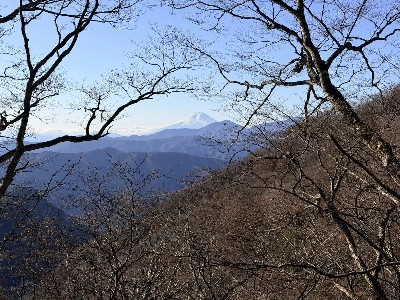
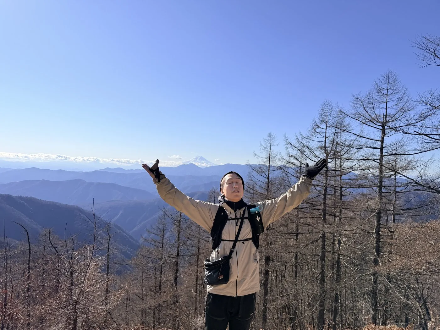
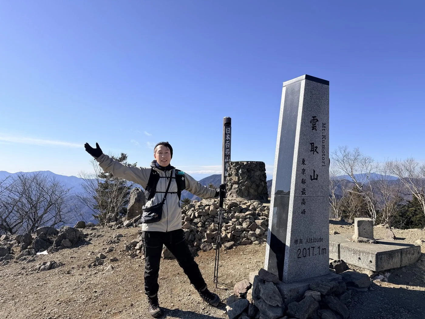
I walked it in mid-December. I set off from the Tabayama village car park at Kamosawa (Kosode-nokkoshi), and in the video I mention that the first stretch was an easy trail surrounded by cedar forest. From there, by way of Dokoro and the Nanatsuishi hut, I reached Mt. Nanatsuishi. From there it is the traverse along the broad Ishione ridge, with Mt. Fuji in view on the right. It was a warm, easy-walking day, with Mt. Fuji and the Southern Alps standing out sharply, and I was able to get down while it was still light.
The editor's measured time was about 7 hours 17 minutes including breaks (departing 07:18, summit 11:30, down at 14:35), over a distance of about 20 km. There are few technical difficulties, but it is a mountain that tests your stamina to walk the long ridge from end to end. A day trip is possible, but staying at the emergency hut just below the summit or at Kumotori-sanso to enjoy the views at dusk and in the morning is a charm of its own.
Because the distance is long at about 20 km, an early start and good pacing matter. The Ishione ridge has fine views, but the wind can be strong with little shelter, so bring warm clothing. In winter there is snow and ice, so winter mountaineering gear is required. In the short days of the year, plan so that you can get down while it is still light.
Routes
Choose your route
The Kamosawa route (out and back via Kosode-nokkoshi and the Ishione ridge)
Out and back
Difficulty
Intermediate
Approx. time
About 7 hours 17 minutes (editor's measured time) / about 10 hours standard
Day trip
Day trip possible · for strong walkers (Kumotori-sanso and the emergency hut are options too)
Starting from Kamosawa (Kosode-nokkoshi), you pass Dokoro and the Nanatsuishi hut on the way to Mt. Nanatsuishi. From there it is the classic route along the broad Ishione ridge, with Mt. Fuji on your right, past Buna-zaka and Mt. Kokumotori to the summit. There are few technical difficulties, but at about 20 km round trip it is long and a real test of stamina. A day trip is possible, but planning a night at the emergency hut just below the summit or at Kumotori-sanso is popular too.
The Mitsumine route (Saitama side) · traverse
Traverse
Difficulty
Intermediate
Approx. time
From Mitsumine Shrine to the summit
Day trip
An Okuchichibu traverse with a hut stay is also possible
This includes the route climbing from Mitsumine Shrine on the Saitama side by way of Kiriganemine and Mt. Shiraiwa, and it also serves as the starting point of a traverse along the Okuchichibu main ridge toward Mt. Kobushigatake. Kumotoriyama stands at the border of the three prefectures of Tokyo, Saitama and Yamanashi — a keystone mountain at the eastern end of Okuchichibu.
Editor's record
Editor's measured times
The editor's actual timings on this hike (from the video record). Use them as a guide to course times.
07:18Depart the Tabayama village car park (Kosode-nokkoshi)
09:52Mt. Nanatsuishi (onto the Ishione ridge with Mt. Fuji in view)
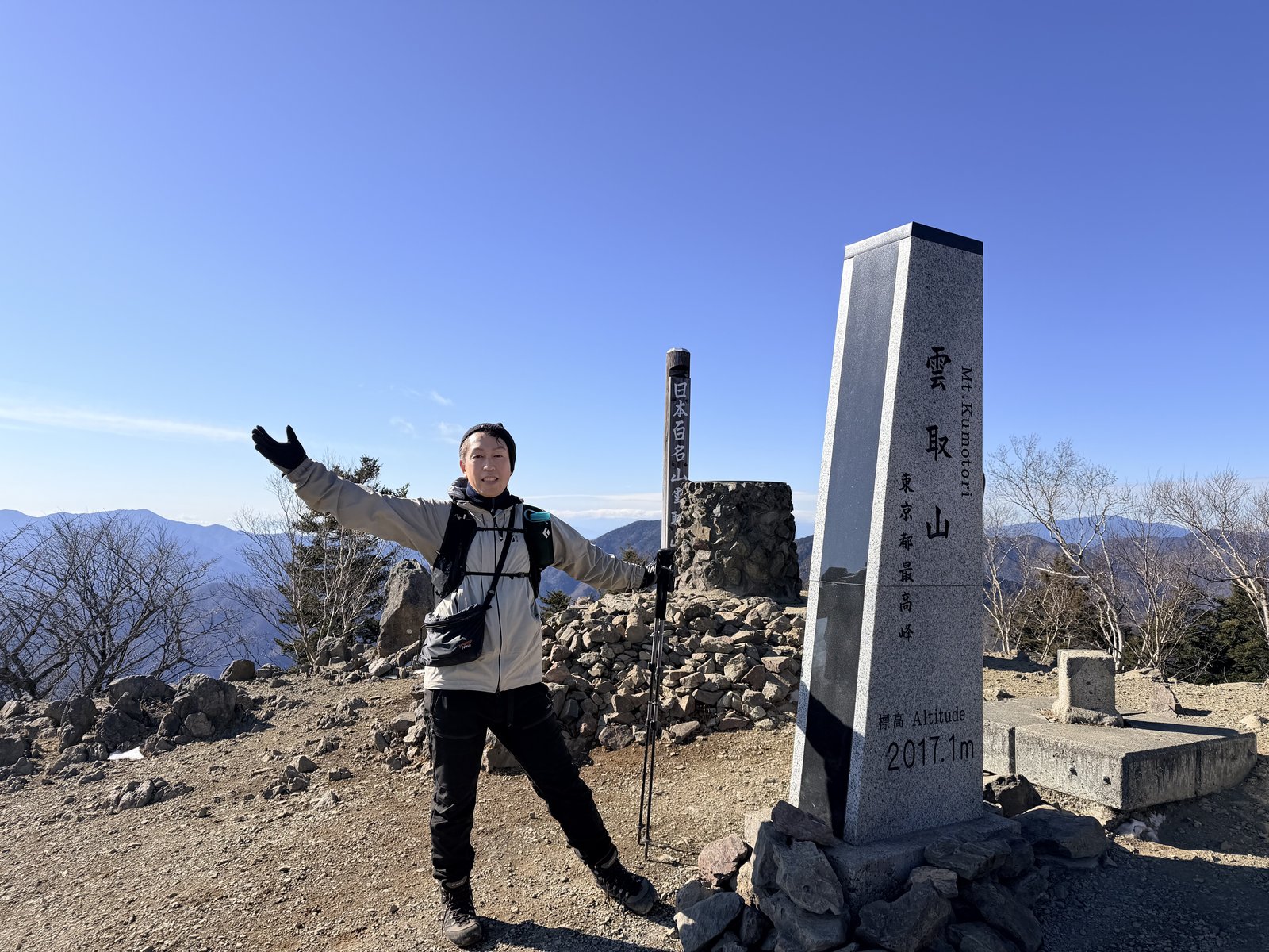
11:30Reach the summit of Kumotoriyama (2,017 m; highest peak in Tokyo)
14:35Descend to the car park (about 7 hours 17 minutes round trip)
History & culture
History & culture
Kumotoriyama is a 2,017 m mountain rising at the border of Tokyo, Saitama and Yamanashi. It is the highest peak in Tokyo and one of Japan's 100 Famous Mountains. Sitting at the eastern end of the Okuchichibu main ridge, it has long been loved as a serious mountain accessible from the greater Tokyo area.
From the summit spread views of Mt. Fuji, the Southern Alps and the mountains of Okuchichibu. The broad ridge path known as the Ishione is covered in natural forest of larch and beech, and walking the crest with Mt. Fuji in view is its great charm.
Because it sits at the border of three prefectures, several trails converge on the summit — Kamosawa on the Tokyo side, Mitsumine Shrine on the Saitama side, and Taba on the Yamanashi side. As its elevation is exactly 2,017 m, it drew many hikers in 2017. On a traverse of the Okuchichibu main ridge it also becomes the starting point of the long crest toward Mt. Kobushigatake — a keystone mountain of the eastern Okuchichibu.
Photos
Photos from the trail
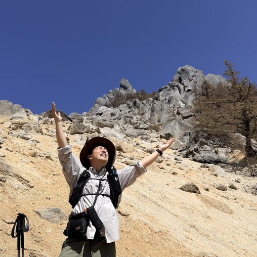
All photos were taken by the editor on the actual hike. Tap to enlarge.
The trail from Kamosawa is clear and has few dangerous rocky sections, but at about 20 km round trip with over 1,500 m of elevation gain it is long and suited to strong walkers. A day trip is possible (about 7 hours 17 minutes by the editor's own measurement), but staying at the emergency hut just below the summit or at Kumotori-sanso gives you more of a margin. In winter, winter mountaineering gear is required.
Can it be done as a day trip?
Strong walkers can make the round trip in a day. The editor did it in December in about 7 hours 17 minutes including breaks. But in the short days of the year an early start is essential so you can get down while it is still light. If you are unsure about the time, staying one night and enjoying the views at dusk and in the morning is also recommended.
Where is the car park?
The Tabayama village car park at Kamosawa (Kosode-nokkoshi) is the usual starting point. It can fill up early in the morning on weekends. You can also reach it by bus from Okutama Station (Kamosawa-nishi bus stop).
Is it really the highest peak in Tokyo?
Yes. Kumotoriyama (2,017 m) is the highest peak in Tokyo and sits at the border of the three prefectures of Tokyo, Saitama and Yamanashi. The summit is on the Tokyo side, and on a clear day you can see all the way to Mt. Fuji and the Southern Alps.