
Sekison Shrine route
Part of the loop (one way)In the video this route is described as a "somewhat steep, tough climb." The editor says the trailhead sign displayed "for advanced/intermediate hikers" (reported in the video, March 4, 2026).
Mountain Guide | Southern Alps
Amagoidake is a 2,036 m peak rising as an outlying summit of the Southern Alps in Hokuto City, Yamanashi. On March 4, 2026, the editor walked the loop route linking the Sekison Shrine trailhead and the other trailhead, in conditions just after fresh snowfall the previous day.
Location & access
Coordinates are provisional values from the GSI (Geospatial Information Authority of Japan) place-name and elevation APIs; they will be replaced with measured values once the GPX track is imported.
Watch
Editor's note
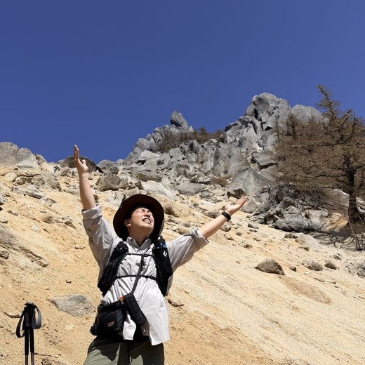
Amagoidake is a 2,036 m peak rising as an outlying summit of the Southern Alps in Hokuto City, Yamanashi. In the video, the editor describes it as "one of the Yamanashi Hyakumeizan," though this has not yet been officially confirmed (verification pending). There are two trailheads — the Sekison Shrine side and the other trailhead — and, as the video's title "loop hike" suggests, they can be linked together into a single route.
The editor walked it on March 4, 2026, just after snow, sleet, and rain had fallen the previous day. After gathering at Sekison Shrine, the group drove to the other trailhead and began climbing from there. He also mentions spotting deer tracks and deer themselves near the trailhead.
In the video, the route from the other trailhead is described as "beginner-friendly and easy to climb," while the route from Sekison Shrine is called "a somewhat steep, tough climb." In fact, he says the trailhead sign read "for advanced/intermediate hikers," suggesting a real difference in difficulty between the two courses. However, all of this reflects the editor's experience on March 4, 2026, in snowy conditions, and the actual difficulty in the snow-free season may differ.
Because of the previous day's snowfall, the trail reportedly required trail-breaking, and the editor recalls that the trail markers were buried and hard to see. He felt that summer-style chain traction devices weren't enough and switched to winter poles partway through. There was also a section with a fixed rope, which he says was reassuring to use on the descent. All of this is a snapshot from March 4, 2026, and conditions will vary by season and year. If you plan to hike in snowy conditions, always check the latest snow and trail-closure information beforehand.
The video also mentions that the forest road to the other trailhead is closed in winter. On the day of filming (March 4, 2026), the editor notes that in summer you can drive close to the trailhead, but the exact period and section of the winter closure have not been confirmed. It's recommended to check the latest information before visiting.
From the summit, given good weather, views are said to open up toward Mt. Fuji, the Southern Alps, and the Yatsugatake range. On the day of the editor's visit, the summit area was clouded over at times, but he describes a beautiful scene of snow and ice clinging to the trees. The mountain's name is said to come from rain-praying rituals once held on it during droughts, and several other mountains around the country reportedly share similar names. It doesn't have the same recognition as the neighboring Hinatayama's "Sky Beach," and the video describes it as living "somewhat in that mountain's shadow, not especially well known."
*This article is a draft written before GPX data has been imported. Distance, cumulative elevation gain, measured course time, precise trailhead coordinates and addresses, and the latest trail-closure status will be added in future updates.
Routes
In the video this route is described as a "somewhat steep, tough climb." The editor says the trailhead sign displayed "for advanced/intermediate hikers" (reported in the video, March 4, 2026).
In the video this route is described as "beginner-friendly and easy to climb." The editor began his climb from this side (around the 5:00 mark in the video). There were several variations in how the place names were pronounced, and the official route name and trailhead name are still being confirmed.
History & culture
Amagoidake is a 2,036 m peak located as an outlying summit of the Southern Alps in Hokuto City, Yamanashi. In the video, the editor describes it as "one of the Yamanashi Hyakumeizan (100 Famous Mountains of Yamanashi)," though this has not yet been confirmed against an official list (verification pending).
As for the origin of the name, the video explains that it is said rain-praying rituals were once held on the mountain during droughts. Several other mountains around the country are said to be called "Amagoidake" or similar for the same reason.
Locally, it does not have the same recognition as the neighboring Hinatayama's "Sky Beach," and the video describes it as "living somewhat in that mountain's shadow, not especially well known." There are two trailheads — the Sekison Shrine side and the other — and, as the video's title suggests, they can be linked together in a loop hike.
FAQ